PTL PR5HikingOfficially certified trail
Percurso da Agua
Ponte de Lima, Viana do Castelo
Difficulty
Moderate
Distance
13 km
Duration
6h
Elevation gain
41 m
Type
Loop
Description
Machine-translated from Portuguese.
The
Water Trail is a walking trail classified as a short route. The
markings and signage comply with international standards. The
trail runs through the area surrounding the Protected Area of the
Lagoons of Bertiandos and S. Pedro d’Arcos, providing insight into the
origin and movement of water in the area.
We begin the route at the Environmental Interpretation Center, following the signs to Quinta de Pentieiros—part of the Protected Area project—which features facilities for lodging, recreation, and leisure, as well as an educational farm. It can be visited for a nominal fee. Along the route , urban areas associated with complex parcel-based agricultural systems predominate. Returning to the trail, we head toward Estorãos. We come upon the Arga and Cabração mountain ranges— the upper limits of the Estorãos River watershed. This basin, covering approximately 5,440 ha, has the Estorãos River as its main watercourse. Its characteristics, combined with climatic conditions, account for the formation of a valley area subject to periodic flooding, where the Protected Area is located.
Next to the Church of Estorãos, we turn right toward the bridge and the Estorãos waterwheel. We leave the riverside landscape behind, crossing the bridge toward the Lousa valley. In this agricultural area, there are signs referring to the Estorãos irrigation system, whose water comes from a catchment upstream on the river. At the Statue of the Four Hands, a symbol of the union of four parishes in the face of serious subsistence problems, we turn right, heading toward the Old Estorãos Cooperative.
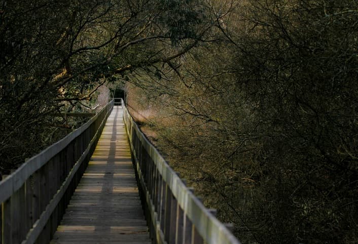
We turn left and are accompanied by the irrigation canal that carries water for irrigation in the Sobreiro valley and to the S. Pedro d’Arcos lagoon, thus ensuring the maintenance of this biotope in the summer. After crossing the Estorãos River once more, we turn left onto a trail that leads us to the Mimoso Lagoon. We pass over a wooden bridge where, in winter, water from the river flows into the Fujacos stream, forming a temporary lake in the Protected Area.
The lagoon, a biotope of paramount importance for wildlife, serving as a refuge, feeding , and breeding ground, consists of a seasonal body of water surrounded by hygrophilous forests that harbor species of high conservation value. The lagoons of the Protected Area, situated in natural depressions in the terrain, are fed by rainwater, by the rising water table, by the Leira Longa and Portela streams, and by the Estorãos irrigation system.
From the Mimoso pond, following the route markers, we head toward National Road (EN) 202, next to which stands the Solar de Bertiandos, one of the landmarks of the north of the country. We continue parallel to EN 202, once again taking in the Arga mountain range, and, looking in the opposite direction, we catch a glimpse of the riparian gallery of the Lima River, the southern boundary of the Estorãos River watershed. The Lima receives the waters drained by the Estorãos and the Estado ditch, a watercourse built to drain the S. Pedro d’Arcos lagoon, causing it to flow out of the basin. At the end of the straight stretch, we turn right and follow the signs to the Environmental Interpretation Center, passing by Quinta da Lage, founded in the 15th century.
We begin the route at the Environmental Interpretation Center, following the signs to Quinta de Pentieiros—part of the Protected Area project—which features facilities for lodging, recreation, and leisure, as well as an educational farm. It can be visited for a nominal fee. Along the route , urban areas associated with complex parcel-based agricultural systems predominate. Returning to the trail, we head toward Estorãos. We come upon the Arga and Cabração mountain ranges— the upper limits of the Estorãos River watershed. This basin, covering approximately 5,440 ha, has the Estorãos River as its main watercourse. Its characteristics, combined with climatic conditions, account for the formation of a valley area subject to periodic flooding, where the Protected Area is located.
Next to the Church of Estorãos, we turn right toward the bridge and the Estorãos waterwheel. We leave the riverside landscape behind, crossing the bridge toward the Lousa valley. In this agricultural area, there are signs referring to the Estorãos irrigation system, whose water comes from a catchment upstream on the river. At the Statue of the Four Hands, a symbol of the union of four parishes in the face of serious subsistence problems, we turn right, heading toward the Old Estorãos Cooperative.
We turn left and are accompanied by the irrigation canal that carries water for irrigation in the Sobreiro valley and to the S. Pedro d’Arcos lagoon, thus ensuring the maintenance of this biotope in the summer. After crossing the Estorãos River once more, we turn left onto a trail that leads us to the Mimoso Lagoon. We pass over a wooden bridge where, in winter, water from the river flows into the Fujacos stream, forming a temporary lake in the Protected Area.
The lagoon, a biotope of paramount importance for wildlife, serving as a refuge, feeding , and breeding ground, consists of a seasonal body of water surrounded by hygrophilous forests that harbor species of high conservation value. The lagoons of the Protected Area, situated in natural depressions in the terrain, are fed by rainwater, by the rising water table, by the Leira Longa and Portela streams, and by the Estorãos irrigation system.
From the Mimoso pond, following the route markers, we head toward National Road (EN) 202, next to which stands the Solar de Bertiandos, one of the landmarks of the north of the country. We continue parallel to EN 202, once again taking in the Arga mountain range, and, looking in the opposite direction, we catch a glimpse of the riparian gallery of the Lima River, the southern boundary of the Estorãos River watershed. The Lima receives the waters drained by the Estorãos and the Estado ditch, a watercourse built to drain the S. Pedro d’Arcos lagoon, causing it to flow out of the basin. At the end of the straight stretch, we turn right and follow the signs to the Environmental Interpretation Center, passing by Quinta da Lage, founded in the 15th century.
Route
Reviews
No reviews yet. Be the first!
Nearby trails
PTL PR4
PTL PR7
PTL PR6
VCT PR22
Trilho dos Romeiros de Geraz do Lima a Serra d’Arga
Viana do Castelo
- Distance
- 25 km
- Duration
- 7h
ModerateLoop
PTL PR3
Trilho da Serra D’Arga Lobo Atlântico
Ponte de Lima, Viana do Castelo
- Distance
- 8.5 km
- Duration
- 4h
EasyLoop
VCT PR20